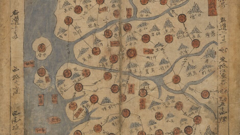
Despite the attentions of cultural historians since the 1980s, maps still tend to escape close and critical study as fundamentally visual and material forms of communication, with histories of cartography remaining predominantly disconnected from these dimensions of the subject matter. This two-day symposium addresses this interdisciplinary challenge from a diverse range of perspectives that foreground such questions as: how do maps operate as representations, and how do culturally situated understandings of space shape how they are created, seen and read? How does the study of maps within specific historical or cultural contexts connect to broader issues in visual/material history? In what ways are coloniality and/or indigeneity made visible/material in maps? How can art-historical approaches inform other disciplinary analyses and uses of maps? Invited speakers will offer new perspectives through studies of cartographic objects from around the world, from early modern India, Iran, and China to the Atlantic world and contemporary South Africa.
Organised by Emily Mann (Bartlett School of Architecture) & Stephen Whiteman (The Courtauld)
Speakers:
Zoltan Biedermann, School of European Languages, Culture, and Society, University College London
Alexandria Brown-Hejazi, Department of Art History, Stanford University
Tristan Brown, Department of History, MIT
Chanchal Dadlani, Department of Art History, Pomona College
Georges Farhat, Daniels Faculty of Architecture, Landscape and Design, University of Toronto
Susan Elizabeth Gagliardi, Art History Department, Emory University
Çiğdem Kafescioğlu, Department of History, Boğaziçi University
Olanrewaju Lasisi, School of Architecture, University of Virginia
Emily Mann, Bartlett School of Architecture, University College, London
Matthew Francis Rarey, Department of Art History, Oberlin College
Rose Marie San Juan, Department of History of Art, University College, London
Stephen H. Whiteman, Courtauld Institute of Art, University of London
Presented with support from the British Academy, the Leverhulme Trust, the Courtauld Institute of Art, and the Bartlett School of Architecture.
Programme:
Tuesday 20th June
09.00 Registration
09.30-09.45 Welcome (Lecture Theatre 2)
Emily Mann, (Bartlett School of Architecture) & Stephen Whiteman, (The Courtauld)
09.45-11.00 Panel 1
Chair: Sussan Babaie (The Courtauld)
Mapping Water in Early Modern Istanbul: City and Nature, Past and Present in Cartographies of Hydraulic Infrastructure
Çiğdem Kafescioğlu, Department of History, Boğaziçi University
The Practice of Perspective in J. A. du Cerceau’s Topographical Views and Maps
Georges Farhat, Daniels Faculty of Architecture, Landscape and Design, University of Toronto
11.00-11.30 Break (Research Forum)
11.30-12.45 Panel 2
Chair: Stephen Whiteman, (The Courtauld)
Mapping Fengshui: The Production, Functions, and Uses of Geomantic Images in Qing China
Tristan Brown, Department of History, MIT
On the Architecture of Ritual Movements and the Cartosemiotic Properties of Yoruba Potsherd Pavement
Olanrewaju Lasisi, School of Architecture, University of Virginia
12.45-14.14 Lunch (provided for speakers)
14.15-15.30 Panel 3
Chair: Eleanor Stephenson (University of Cambridge)
Mapping History: The Gentil Atlas and the Circulation of Indo-Persian Knowledge
Chanchal Dadlani, Department of Art History, Pomona College
The Blathwayt Atlas: Bound and Unbounded
Emily Mann, Bartlett School of Architecture, University College London
15.30-16.00 Break (Research Forum)
16.00-17.15 Panel 4
Chair: Thomas Balfe (The Courtauld)
Terra Incognita
Rose Marie San Juan, Department of History of Art, University College London
Gerhard Marx’s Investigations of Maps as Works in Progress
Susan Elizabeth Gagliardi, Art History Department, Emory University
17.15-17.30 Closing
Emily Mann and Stephen Whiteman
17.30-18.30 Drinks Reception (Research Forum)
———————————–
Wednesday 21st June
09.30 Registration
10.00-12.00 Panel 5 (Lecture Theatre 2)
Chair: Caroline Levitt (The Courtauld)
How Local Explorations Created the Global Map: The Part and the Whole in Iberian Renaissance Cartography
Zoltán Biedermann, School of European Languages, Culture and Society, University College London
Imagining ‘China’: Premodern Geo-bodies and Modern Historiography in a Twelfth-Century Stele
Stephen H. Whiteman, Courtauld Institute of Art
Reckoning with Maps After Brazilian Slavery: Lessons from Jaime Lauriano and Rejane Rodrigues
Matthew Francis Rarey, Department of Art History, Oberlin College
12.00 Closing
Emily Mann and Stephen Whiteman
